With controversial plans for another 600 homes on Norwich Common on the northern edge of Wymondham, it's probably worth considering how the town has grown in the last 100 years.
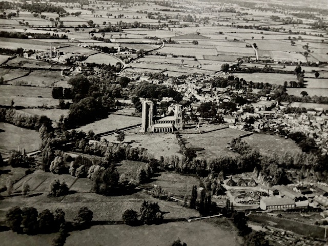
The aerial photo looking at northern Wymondham was taken in 1928. Three years later, the census recorded the population as 5017. Today, it is estimated at 17000.
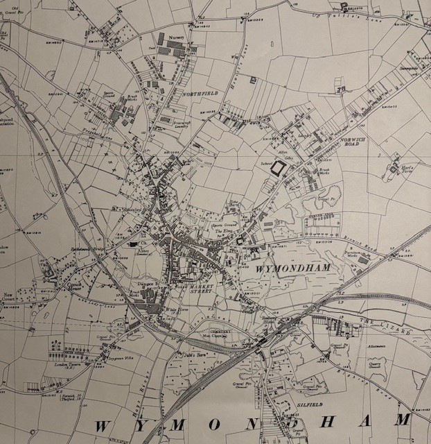
At this time, there were not many houses on Tuttles Lane, and the land between there and Folly Road (sometimes referred to as Folly Lane) was agricultural. The map shown above shows the two brush factories, which between them employed nearly 1000 people: the Co-op towards the top left of the picture and the Briton Brush Company, later Briton Chadwick Ltd, at the bottom right. Both factories closed in the 1980s and were subsequently demolished to make way for housing, while on the north side of the town, big estates had already been built.
In recent decades, there have been many further houses built, for example, off London Road and at Silfield in areas which were once agricultural. The continual building has arguably exacerbated local waiting times for medical appointments.
Wymondham is now a far cry from the place I knew in the 1950s, when I could walk into town from my home on London Road and I probably knew just about everyone I met!